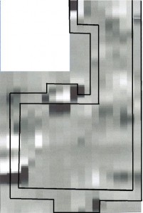
 This a magnetotmetry survey. The outline of Eastwood Hall has been superimposed from the 1851 map. It looks like the same shaped appears under the ground! However until we put a spade in the ground we cannot be sure that archaeology still exists under the ground. The lowest area of the image is where the original entrance to the building should be. The facade would have had stone columns supporting a Pediment. These designs were copies from the Mediterranean. Check out the Roman Pantheon at http://www.crystalinks.com/romepantheon.html. Hopefully we may find some evidence left behind!
Social
-
Recent Posts
Categories
Links
- Centre for Applied Archaeology
- Council For British Archaeology
- day of archaeology lots to check up on internationally
- Geophysical survey in archaeological field evaluation English Heritage guidance 2008
- Greater Manchester Archaeological Federation
- History of the British countryside Excellent presentation of agriculture changes to the countryside
- Huddersfield and District Archaeological Society
- Introduction to Standards and Guidance in Archaeological Practice A good and comprehensive collection of documents to use when starting out
- Manchester Region Industrial Archaeology Society (MRIAS) Website Access to specialist industrial archaeology
- The Dig Site Regional website supporting access to Archaeology in Greater Manchester
- The Friends Of Castleshaw A group pursuing the history and archaeology of Castleshaw including the Roman phase
- The Littleborough Historical & Archaeological Society Now with a new residence in a restored building on the train line.
- The Society of Antiquaries of London Online Newsletter
- Waterlogged Organic Artefacts English Heritage guidance 2012
Meta
